Four inspiring ways drones are making science safer
Dr Kieran Wood helps us revisit the way we think about the humble drone, showing us how they have become a force for good in our skies – and even underground.
From search and rescue and helping firefighters to medical first response and organ delivery, it’s not hard to think of some great uses for drone technology that could be of benefit to the public at large – who knows, this technology may even save your life one day.
However, the reputation of unmanned aerial vehicles has been tarred by a number of high-profile incidents where they’ve been used irresponsibly. Drone attacks on both Gatwick and Heathrow in late 2018 caused major disruption and led to the cancellation of hundreds of flights.
Yet despite the bad press, as a research tool, they are helping scientists to perform some vital and previously near-impossible tasks.
Dr Kieran Wood, a senior researcher in Bristol’s School of Civil, Aerospace and Design Engineering, specialises in drone technology. He is part of a growing team of similar researchers and students in the University of Bristol’s Flight Laboratory. Together, their research and field work reveal how drones can be an incredible force for good.
Here, Dr Wood picks four remarkable case studies that show how drones rush in where humans fear to tread…
1. Radiation mapping
Ultimately, a lot of what drones are used for is getting ‘something’ to ‘somewhere’ … that’s pretty much all they do,” says Kieran – although there’s an air of understatement about this when you realise that the ‘something’ is a radiation detector and that the ‘somewhere’ just happens to be Chernobyl.

The University of Bristol team has taken several trips to the exclusion zone surrounding the ex-power plant in the Ukraine, the scene of the infamous catastrophic nuclear accident in April 1986. During their stay, team members carried out a series of radiation-mapping surveys using drones to fly over the contaminated areas to refine radiation maps and identify hotspots.
Similar work has also been undertaken in the southern Ukraine. Drones were used in tandem with the University’s sensor technologies to assess radiation levels at an abandoned chemical-processing plant where nuclear waste was, as Kieran puts it, “not wrapped up as neatly as it should have been”.
All of these projects seek to provide a better understanding of the radiological hazard whilst humans remain in a safe location
The airborne gamma-ray spectrometry technology developed by the University of Bristol has also been used in the first-ever UAV mapping of the Sellafield site in the UK and has also been deployed numerous times in the Fukushima Prefecture in Japan.
All of these projects seek to provide a better understanding of the radiological hazard whilst humans remain in a safe location. “The detailed maps produced allow authorities to make more informed decisions about access and cleanup efforts”.
2. Volcano monitoring
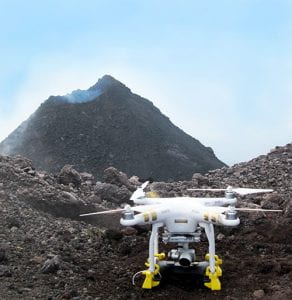
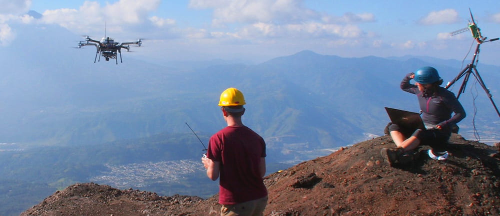
If hovering over areas contaminated with radiation wasn’t heroic enough, then how about flying into the fiery plume of an active volcano? In 2017, Kieran was part of a team that undertook a 10-day research trip to Guatemala. Specifically, to the active peak of Volcán de Fuego – “it erupts all the time, you can’t go anywhere near it”.

“During this campaign, we were able to meet significant science and engineering targets,” says Kieran. “For example, multiple imaging flights over several days captured the rapidly changing topography of Fuego’s summit. These flights also showed that the volcano was erupting from not just one, but two active summit vents” – a detail previously unknown to volcanologists.
Such monitoring looks to quantify the amount and types of volcanic emissions in the atmosphere – part of this focuses on the chemical composition and another focuses on tiny particles of ash which can float many kilometers from the vent. Fixed-wing drones – like small aircraft with wings – could ascend from the safety of the operations base and capture samples of the ash directly from the air.
Expand your knowledge
The eruption of the Icelandic volcano (deep breath) Eyjafjallajökull in April 2010 caused enormous disruption to air travel across western and northern Europe. So it follows that the data collected from trips of this kind is of great value to airlines and aircraft-engine manufacturers alike. Active volcanoes also pump a lot of carbon dioxide out into the atmosphere; the team’s work has provided data that helped measure the effect of eruptions on the Earth’s carbon cycle.
3. Wind-turbine inspection
Another frontier-expanding research area that’s a focus of the Bristol Flight Laboratory is the maintenance of wind turbines. Following the same rhetoric, the something in this case is a mini inspection and repair robot, and the ‘somewhere’ is a remote offshore wind turbine blade.
The inspection of a wind turbine blade requires specialist ropework skills and puts whole teams of people at higher risk while accessing the blades. But, “people are making robots for these tasks, all you have to do is get them there, and then recover them at the end.” There’s that casual understatement again….
Although there are plenty of opportunities to take the drones out of the lab and apply them to monitoring and data collection projects, a large part of Kieran’s remit as a research engineer is to improve the technology behind the drones themselves. For instance, one of his goals is to enable drones to function in a greater range of weather conditions, including powerful winds – something that will prove essential to the inspection of offshore wind turbines.
4. Mine inspections
Mines, sewers, and tunnels also fit into that category of difficult-to-reach locations that need regular inspection. We may think of them as something we see in our skies, but drones are not actually confined to operating overhead and are perfectly capable of exploring underground, though this does come with its own particular set of challenges.
As Kieran explains: “a drone normally needs two things to navigate. A magnetometer – to know which way it is facing, and GPS – to give it a three-dimensional position. neither of those two will work underground! In this case, the drones need to be fitted with alternative mapping and navigation sensors in order to complete their task”. The technological innovations needed to move away from the robust solutions when operating above ground provide a rich set of research challenges for the lab to work on.
So, as Kieran’s case studies from the Flight Laboratory have shown, from monitoring nuclear contamination and volcanic plumes to inspecting offshore wind turbines and exploring dangerous underground environments, and contrary to sensationalist headlines, drones are essential research tools that perform remarkable tasks in the name of science.
Academic profile
Name: Dr Kieran Wood
Title: Senior Researcher at the Faculty of Engineering
Kieran’s story:
“I did a Master’s in Aerospace Engineering. At the time, drones weren’t quite as widespread as they are now. I got to the end of that and there was the opportunity for a PhD focusing on indoor drones navigating unknown environments. I love building things with my hands and so it struck me as a great opportunity to continue topping up my knowledge of aerospace while physically working with robotic systems at the same time.
“It went well, and I had loads of fun at the Bristol Robotics Laboratory. I then left the University to apply my control-theory skills on helicopters, but, in all honesty, the stuff we were working on would have turned a full-size person-carrying helicopter into a drone. Which is a big reason why I’m back here now.”
“I’m currently working for the National Centre for Nuclear Robotics grant, focusing on improving airborne radiation survey technology and methods”.


